There are obvious challenges to living a nomadic life when world travel has come to a grinding halt. This is not a complaint, since complaining during a pandemic when we are healthy and always have access to safe shelter, food, and water, would be unseemly. But it is a fact that, because we don’t have a home and yet we were expected to get home and stay there, we have been unclear about where we should or could be.
After arriving in Vancouver from New Zealand, and isolating there for two weeks, we spent the next two and a half months at our son’s home. We hope that our being there to keep our grandson, Alex, occupied while his parents worked upstairs, and sharing in the household chores, cooking, and groceries, were a reasonable trade-off for what could not have been an easy transition for them. Once day camp opened, though, it was time for Alex to spend time with kids his own age, which meant that he didn’t need us around as much anymore and staying would increase our exposure to COVID-19. Time for us to leave, but to where?
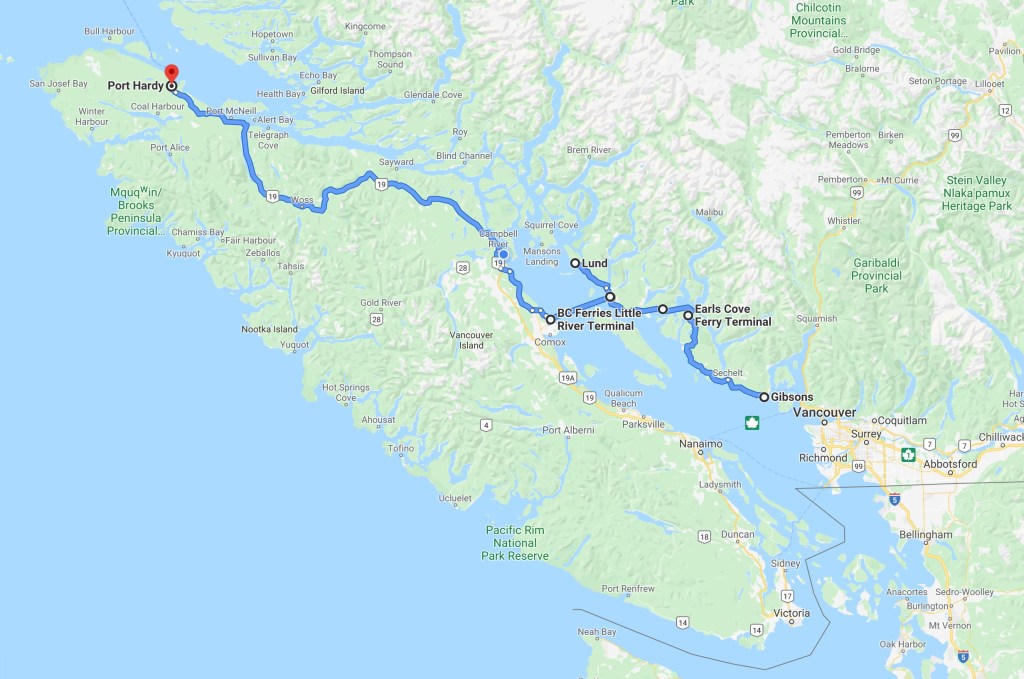
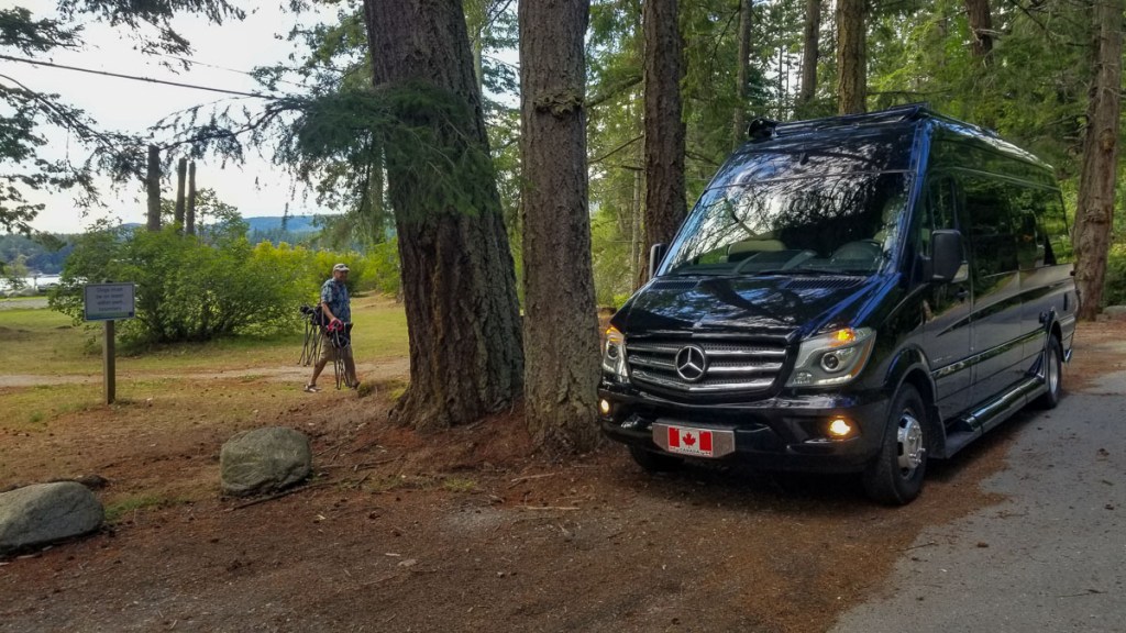
The logical thing for us to do, as joint owners of Artie, a little home on wheels, was to head out and explore. We had been reluctant to do this earlier since our official address is in Alberta, our car and van licence plates are from Alberta, but Artie had spent the winter at his other owner’s home in Gibsons on the Sunshine Coast, British Columbia. With recommendations from both BC and Alberta to stay home, and stories of Albertans being shunned when traveling in BC, we weren’t sure we wanted to take the risk. Finally, though, BC’s top doc opened the door to BCers to travel around their province and made it clear that, though staying close to home was still a recommendation, neither province had ever closed their borders. With that, and anecdotal evidence that probably every provincial license plate had been seen on the ferry between Vancouver and the Sunshine Coast, we decided to make the drive, always following appropriate protocols. Thankfully, we didn’t run into any negative incidents along the way.
We spent a week in Gibsons, mostly getting Artie ready (he needed a little TLC) and figuring out where we would go. Our goal was to find new experiences, even though we couldn’t resume international travel. With a starting point on the southern Sunshine Coast, we chose to continue north, where we’d only travelled as far as Earl’s Cove, to Powell River and Lund. We had also not travelled north of Courtenay/Comox on Vancouver Island, so it seemed like a great time to take the ferry across the channel from Powell River to Comox, and spend time on the northern part of the island.
As for accommodation, we knew that provincial parks weren’t open to us—only open to BCers this summer—and that we would need to find other options. So we pulled out our camping apps and looked for boondocking/wild camping sites and private or regional campgrounds. We were really happy with our choices.
Gibsons through Sechelt to Halfmoon Bay
Highlights
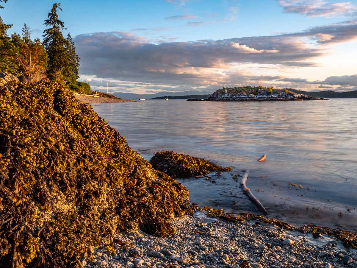
We took an off-the-highway drive (following Red Roofs Road) about 20 minutes north of Sechelt to find a little park on the bay. It was such a pretty spot we decided to stay the night.


Accommodation
Location: Cooper’s Green Park, Halfmoon Bay
Site type: Free camping
Site features: We parked off the road right outside of the park. Daytime traffic was all for the boat launch. Bathrooms are open 9:00 am to 9:00 pm with a porta potty open outside of those hours. The park is closed at 11:00 pm. Parking on the roadside, we had a direct view of the beach and ocean. In the morning, we walked through the park to the beach and sat there enjoying our coffees. The road and park were beautifully quiet all night.
Halfmoon Bay to Earl’s Cove, ferry to Saltery Bay, drive to Lois Lake
Highlights
We were going to stop and do a hike at Homesite Creek, and possibly stay another night on the southern Sunshine Coast, but we got the directions wrong for the hike and searched for the trailhead in the wrong location. Once we found it (after driving back to the highway and retracing our tracks a little), we had lost interest and decided to keep driving to the ferry at Earl’s Cove. Next time we’re in the area, though, we’ll be sure to do the Homesite Creek Trails.
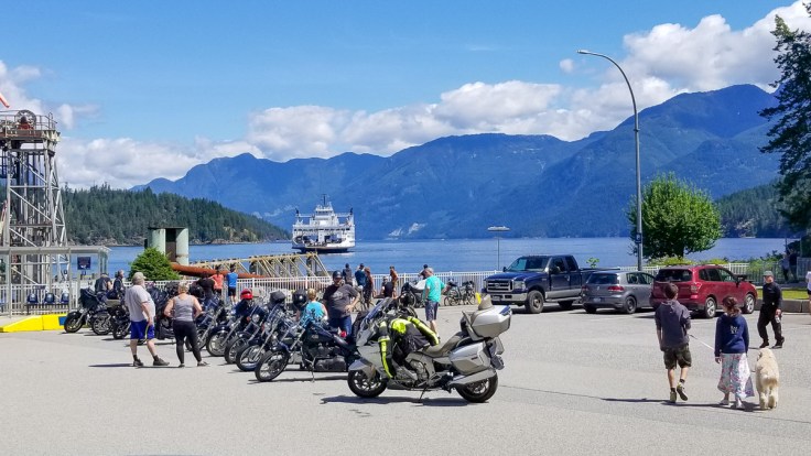
At the ferry terminal there was no wait (other than because we arrived almost two hours before the next ferry) for the 50-minute trip to Saltery Bay. Because fares are paid round-trip southbound on this ferry, it is free to travel north.
We decided to make a stop for the afternoon and evening before going into Powell River, and picked Lois Lake.
There are a few cabins on the lake—and I really mean ON the lake. We talked to one owner who was out walking his dog and he confirmed that the only homes in the area are built on the lake as floating homes and have lake lease agreements.

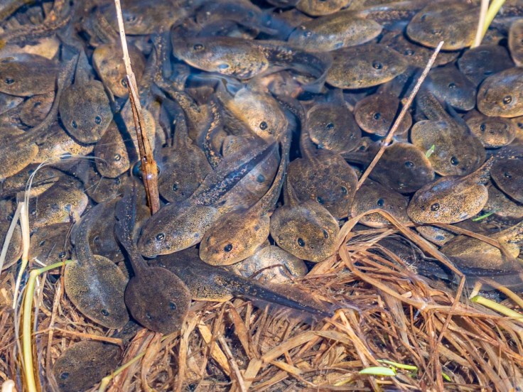
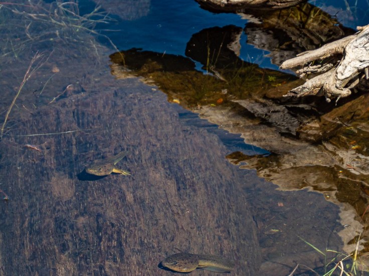

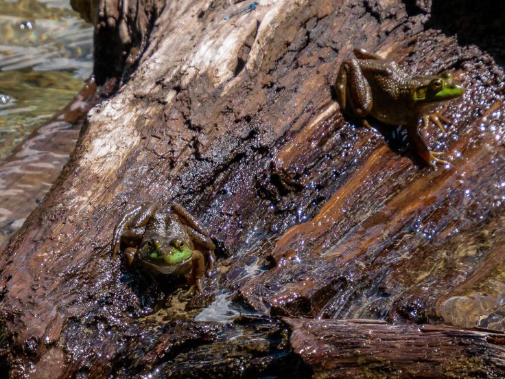
At the end of the lake is the curved Lois Lake Dam, which you can see by walking a kilometre or so down the gravel road. On an evening walk, we were treated to roiling clusters of tiny tadpoles at the water’s edge along with a few larger ones, which we presumed would become bullfrogs.
Accommodation
Location: Parking area near boat ramp on forestry road
Site type: Free camping
Site features: Mostly gravel road, but there is one large area, quite flat, that is nestled in the trees. Lake view. Logging trucks went barreling by during the day, but the treed area helped to protect us from dust. Once the trucks stopped, it was very quiet—only people coming back with their boats and loading them onto trailers.

Powell River
Highlights
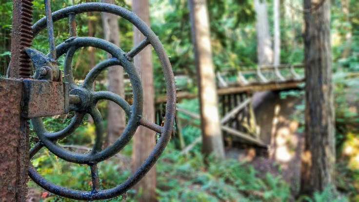
I had Powell River pegged as a smelly industrial town, and we were both surprised to find that it didn’t smell (the pulpmill is no longer operational) and that it was in such a pretty seaside spot. There are many lakes in the area, and many are joined by the Powell Forest Canoe Route, which looks incredible. The campground we stayed at is part of the Willingdon Beach Park, which includes an interesting outdoor logging museum along a walkable and rideable trail. Old equipment is nestled among the trees and can be freely climbed and explored.


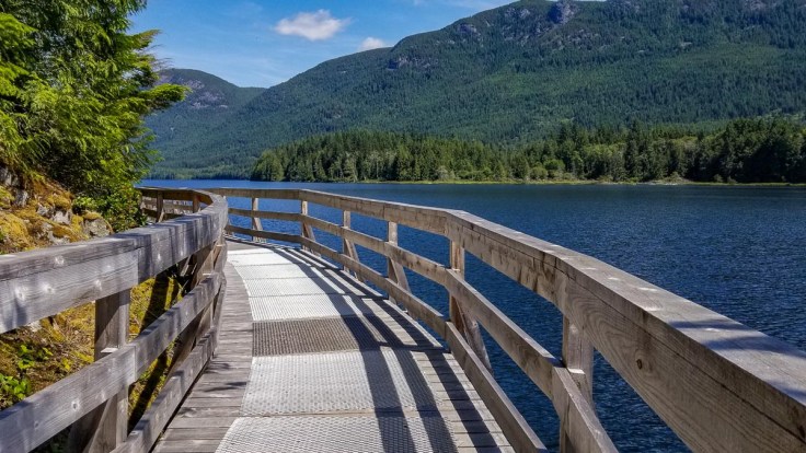
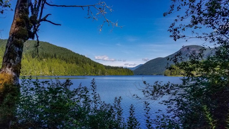
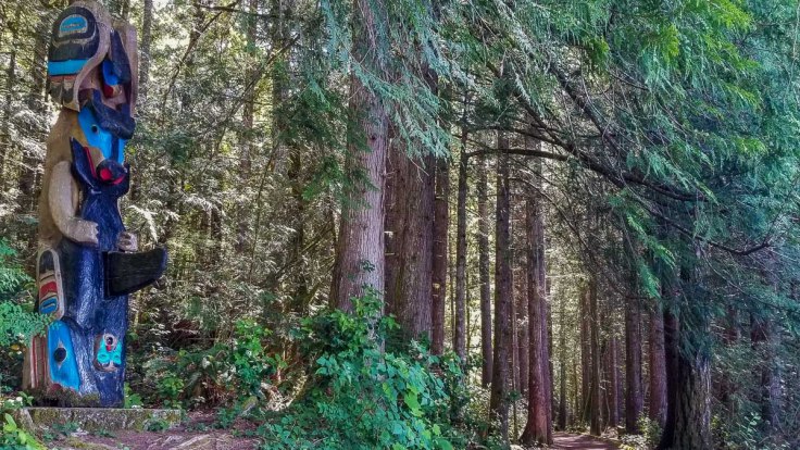
We spent another day out at Inland Lake, which is surrounded by a relatively flat and smooth pathway (it is considered suitable for wheelchairs and strollers). We rode our bikes around the 12.6 km trail, which included boardwalk sections, a totem pole, lots of benches, and a couple of picnic shelters. At one stop at the lake’s edge we found another puddle of tadpoles. A couple of precocious tadpoles (of the larger variety) had already sprouted two legs and sat staring at us from atop logs. There are two huts on the trail as well as the entire circumference is part of the Sunshine Coast Trail hut-to-hut hiking trail.


On our way back to camp we stopped at Mowat Bay Park on Powell Lake, which is home to a popular swimming beach.
Accommodation
Location: Willingdon Beach Campsite
Site type: Regional campground owned and run the by the city of Powell River
Site features: Sites are on the beach or up in the forest with water views. We spent a total of three nights there and liked the higher section. The beach sites were more crowded and a lot noisier, while the sites that we stayed in were very quiet, roomy and shady. Full hookup sites (which we didn’t really need) were a little cheaper than beach sites with or without electricity, and there was a senior (over 60) discount. Decent unlimited WiFi cost $2/day per device (but we purchased it for one device and hot spotted our others to it just fine). Showers were hot and powerful at $1 for four minutes. Laundry was clean and available ($2 wash or dry). Site cost: $34.20.
Dinner Rock (5 km south of Lund)
Highlights
Lund is only a 30-minute drive from Powell River but, as mentioned, we were in no hurry on this trip. So we drove to the camp area early in the day and just enjoyed our surroundings. We explored the pathways up behind the campground and walked down to the colourful rocky beach several times.
Accommodation
Location: Dinner Rock Recreation Site
Site type: Free camping
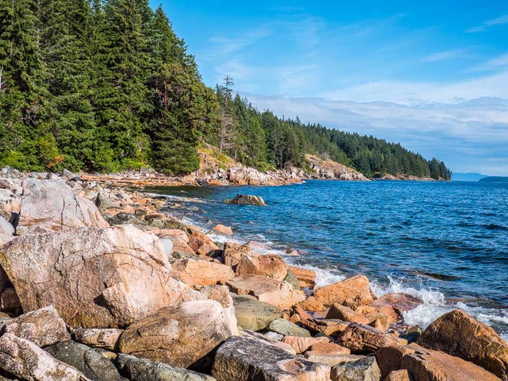
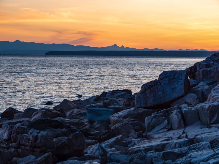
Site features: Though free, there are about 13 proper well-treed campsites here, several sitting right on the cliff over the water. Sites have firepits and there is a pit toilet, but no water. Walk down the road to a beautiful rocky beach with views of Dinner Rock, Savary Island, Texada Island, and across to the mountains on Vancouver Island.

Lund
Highlights
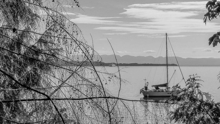
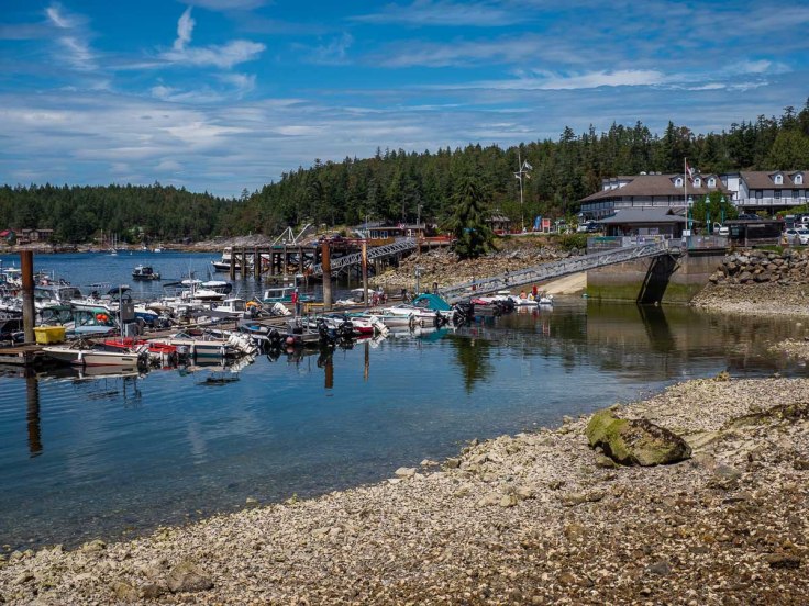
Lund is a small harbour village that bills itself as the gateway to Desolation Sound. You can drive beyond Lund farther up the coast but, as we were warned, the road makes the Sunshine Coast Highway look really good. There were lots of boat activity at the marina and a surprising number of cars parked along the highway and in every available parking spot. The hotel, which seems to practically own the village, or at least all of it’s parking areas, seemed empty, so presumably all of those car owners were out on the water or surrounding islands. There are a couple of marine parks in the area that, along with the many small islands, would offer a fabulous paddling experience. We’ll be keeping this area in mind for a future kayak trip.
Accommodation
Location: SunLund-By-The-Sea Campground
Site type: Private campground
Site features: Well-treed sites of varying sizes. There is a short footpath from the campground to the harbour in Lund where you can take a water taxi to Savary Island, rent a kayak, eat fish and chips, grocery shop, or enjoy coffee and treats at the bakery. WiFi was free, but only accessible near the office’s hotspot. Showers were in private rooms and decent at $1 for three minutes. Site cost: $46.20. Senior discount for stays longer than one night. They advertised some interesting and reasonably priced packages, for example, one that included lunch, five hours of kayaking with a guide, dinner out, and 15% off of two nights’ accommodation, but we were too last-minute to participate.
Powell River and ferry to Vancouver Island
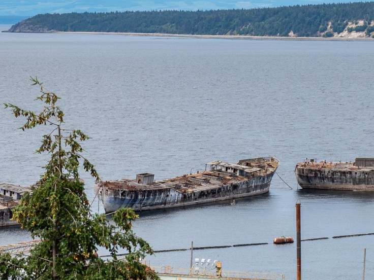
On our way back to Powell River, we were struck by something we had missed on the way north–several ship relics positioned in an arc to form a breakwater outside of the non-operational pulp and paper mill. When we stopped to look, we discovered what is known as The Hulks. We were only able to see a portion of it from the roadside viewpoints, but a sign described the installation as comprising 19 ship hulks. The Hulks is believed to be the largest floating breakwater in the world.

We stayed one more night at the Willingdon Beach Campsite, and then the next morning drove five minutes to the Westview Ferry Terminal, ready to catch a ferry across to Comox on Vancouver Island ($57.40 with Experience Card savings; 1 1/2 hours).
TripBits
- Ferries: All BC Ferries information (schedules, rates, routes) can be found at bcferries.com. Check out the Experience Card for significant savings. You can acquire and load (minimum $95) a card at any ferry terminal ticket booth as you drive in, and then manage it online (register for safety, view activity, add funds).
- To find free camping sites, we found iOverlander (app and website) and freecampsites.net (website only) to be the most useful in the area.

Please drop us a note!