We spent four nights in St. John’s, Newfoundland’s capital city, and then drove south from St. John’s roughly following the scenic drive known as the Irish Loop.
St. John’s
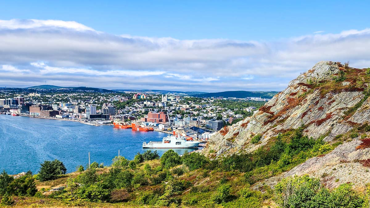
St. John’s is a hilly city nestled in a natural harbour. By water, it is accessed through The Narrows, a historically defensible channel. For hundreds of years St. John’s was a key commercial and administrative hub for the transatlantic cod fishery. It has transitioned to a major supply base for the offshore oil and gas industry. As a working port, there is very limited public access to the waterfront. What, in other towns, might be a seaside boardwalk, in St. John’s is a fenced-off sidewalk with periodic historic interpretive signs. Thankfully, there are many other vantage points from which to view the city’s attractive location.
Most of our time in St. John’s we spent meandering the streets and visiting iconic and interesting spots. On a rainy day we headed up the hill to The Rooms, a cultural landmark that houses the provincial museum and archives. We enjoyed several hours meandering the exhibits and checking out the views.
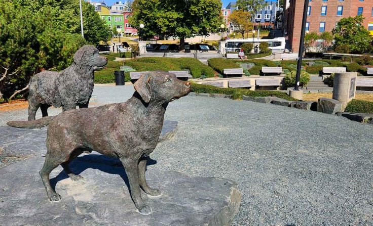
Sculpture of a Newfoundland and a Labrador retriever in Harbourside Park 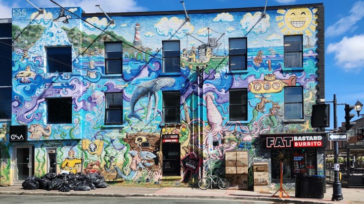
One of many murals 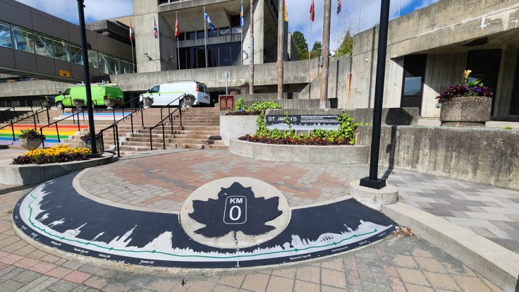
In front of city hall is the Kilometre 0 marker for the Trans-Canada Highway 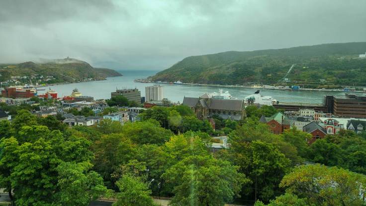
From The Rooms 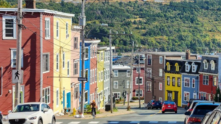
Some of the many Jellybean houses, revitalized in the 1970s 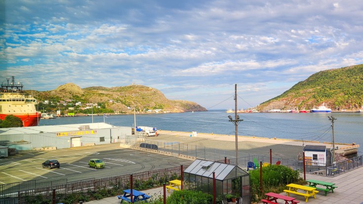
View from our hotel room
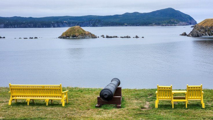
Signal Hill
We checked in at the visitor center and then drove up to the upper parking lot. Though the Cabot Tower is an important piece of history as it is where the first transatlantic wireless signal was received in 1901, it was the views of The Narrows, St. John’s and its harbour, and the North Atlantic Sea that caught our attention.
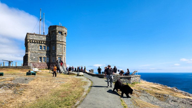
Cabot Tower on Signal Hill 
A view out to sea from Signal Hill 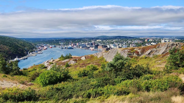
A view of St. John’s from Signal Hill (The Rooms sits atop the hill at the right) 
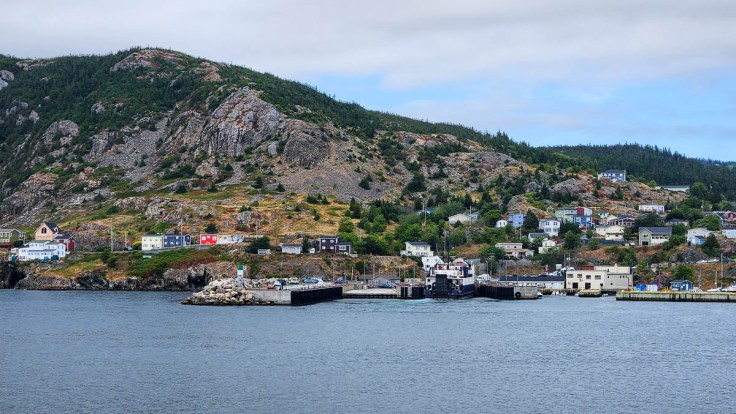
The port in St. John’s
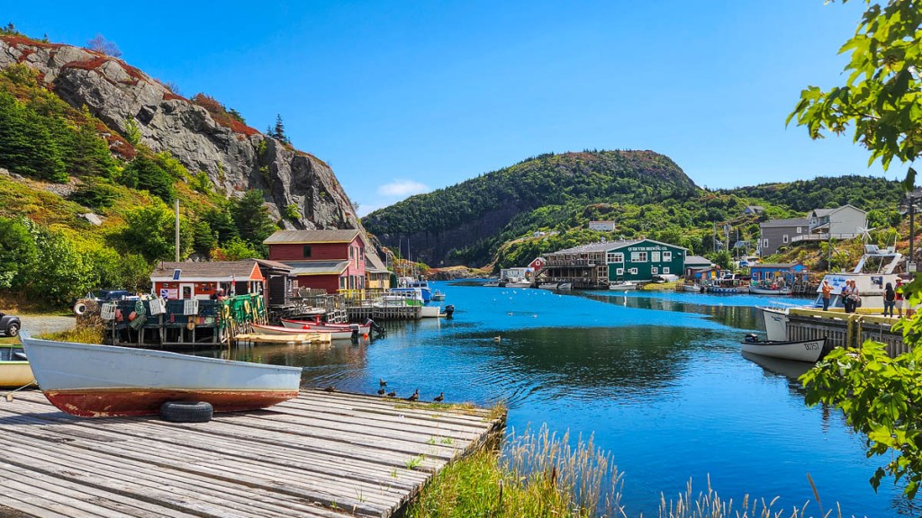
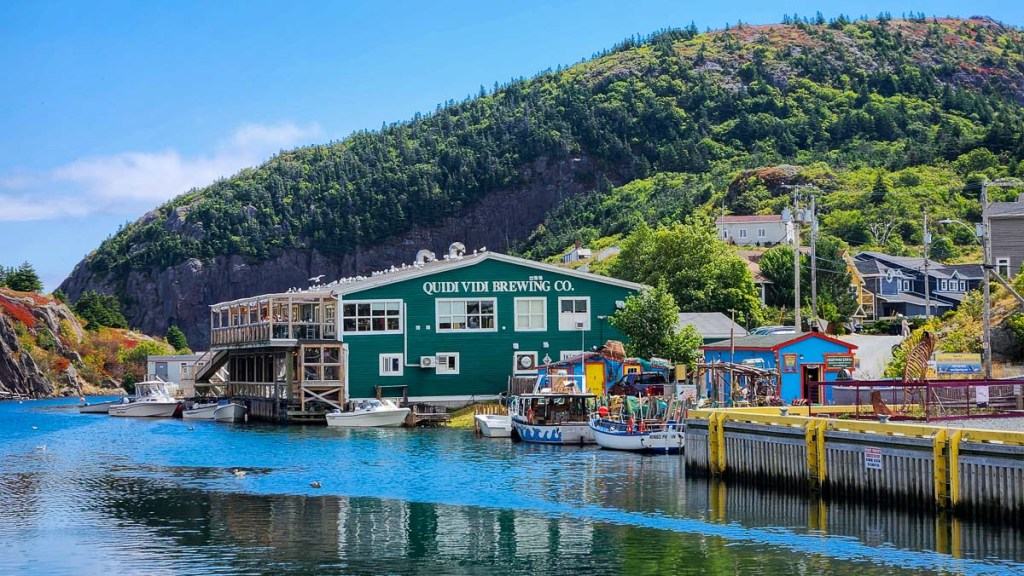
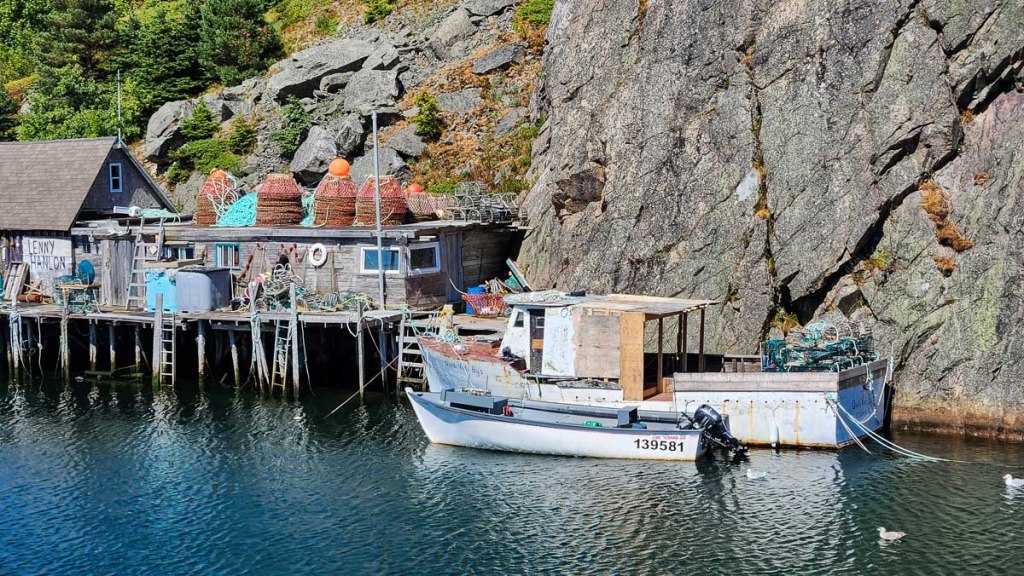
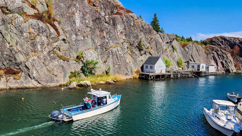
Quidi Vidi
Our son had pointed us to the village of Quidi Vidi and its brew pub. He, of course, had hiked there from Signal Hill. We did not. But we did enjoy the drive to this quaint little spot and, while Ken sipped a beer on the Quidi Vidi Brewing Company patio we watched many hikers up on the ridge across the inlet. Hiking is a spectator sport, isn’t it?
Outskirts and the Irish Loop
Portugal Cove and Fort Amherst
We drove across the Avalon Peninsula to Portugal Cove, mostly for nostalgic reasons. In 1981, we had taken the ferry from here to Bell Island to visit a good friend and her family. This time, we just peered at the island from the ferry ramp and enjoyed the memories.
We thought it would be fun to visit the point across from Signal Hill, marked on the map as Fort Amherst. Not realizing that we couldn’t drive all the way to the fort, we ended up going too far up a narrow, winding, divoty roadway, past several houses, without finding anywhere we could turn the car around. So here’s a tip: If you want to visit Fort Amherst, you must park your car way down at the bottom of the hill if you can find parking and hike up (and you’ll avoid a harrowing reverse drive while entertaining the locals). If you can find a spot, there are also lovely views across to Signal Hill and the colourful houses of Battery Village at its base.
Portugal Cove and the Bell Island ferry ramp 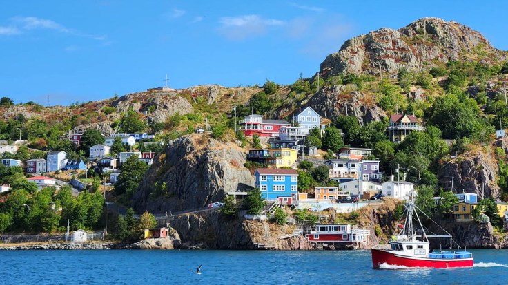
Across the narrows to Battery Village from the road to Fort Amherst
Cape Spear Lighthouse National Park and Petty Harbour
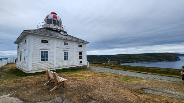
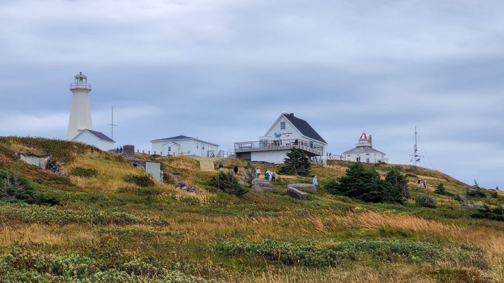
We drove the scenic road out to Cape Spear and were rewarded with the oldest surviving lighthouse in Newfoundland and Labrador (built in 1836). We were also able to walk out to the eastern-most point in North America. Cape Spear is part of the East Coast Trail, so there are many cliff-top walks from which to enjoy the views.
Southwest of Cape Spear is the small fishing village of Petty Harbour-Maddox Cove, one of many little villages we passed through on this journey.
Cape Spear Lighthouse National Park 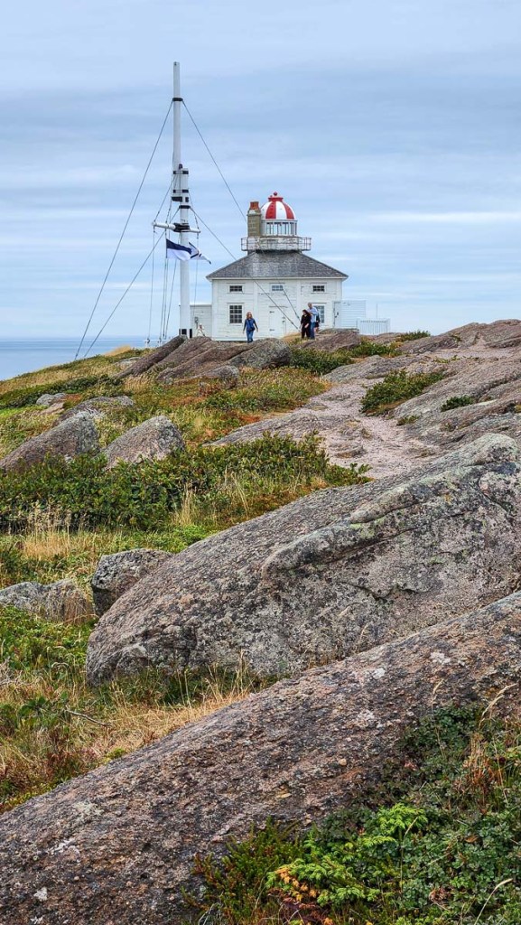
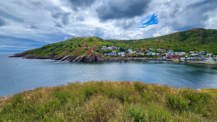
Petty Harbour-Maddox Cove
Ferryland and Cape Race
Ferryland, which you can reach in a little over an hour from St. John’s if you don’t poke around the coast and villages along the way, was our stop for the night. We had booked tickets to attend a dinner theatre event and reconnect with a couple we met earlier in Trinity. We had called to get tickets from Trinity, but they were sold out for this evening. Just a couple of days before we arrived, we received a call with the good news that space had opened up for us. It was fun to surprise the couple we had met and to enjoy an evening of Newfoundland hijinks.
The peninsula leading from the town of Ferryland includes The Downs conservation area, an active archeological site called the Colony of Avalon, which you can tour with a guide, and the Ferryland Head Lighthouse at its tip. Many hike the path to the lighthouse where their pre-ordered picnic awaits them.
Along The Downs 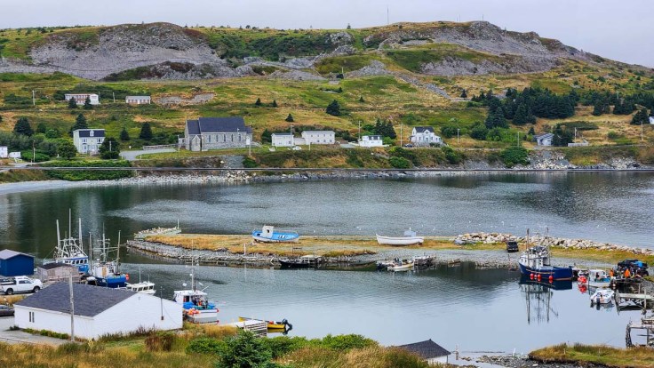
Looking back to Ferryland from The Downs 
Cape Race 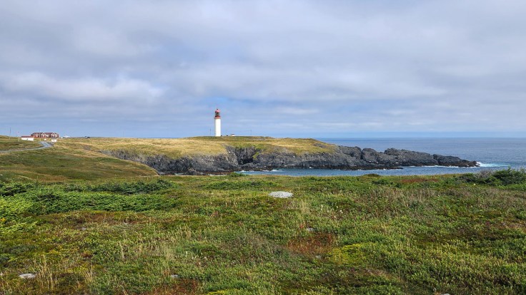
Cape Race Lighthouse
We finished the loop and then drove around Placentia Bay and onto the Burin Peninsula in preparation for boarding a ferry to France. More on that in the next post.
TripBits
- Ferryland dinner theatre: Southern Shore Folk Arts Council and Dinner Theatre. Their website domain errors, so best to contact them through their Facebook page or by e-mail.

We enjoyed one of those Ferryland picnics in 2011!
LikeLike